

Planning Your Journey
Find your way, any time of day
There are lots of apps and websites that can help you find the best route, however you’re travelling. Both CityMapper and Google Maps, for example, allow you to compare different transport options for your journey using a phone app or your computer. Neither app will show you a route that includes Park & Ride, so you will need to route directly there if you’re planning on using that option.
For apps that help with finding your best route by bus, train, cycle or walking, see those pages for more details.

CityMapper shows the times it will take to walk, cycle, ride an e-scooter, catch public transport or ride a taxi; or to use different travel methods in combination.
When you’re getting started, just choose London as your city and it will show you Oxford too.
At the bottom, you can customise your route to your needs by choosing walk less, step-free, simple, fastest, and mixed-mode journeys.
For bike trips, you can further choose quiet, regular or fast to find the best route for you.
For bus or train trips, it will tell you when the next bus or train arrives, and how much walking you will need to do over the course of your trip.
And if you tap “Leave: Now” at the top, you can select the exact time you’d like to leave or to arrive at your destination, to help plan an upcoming or future journey.
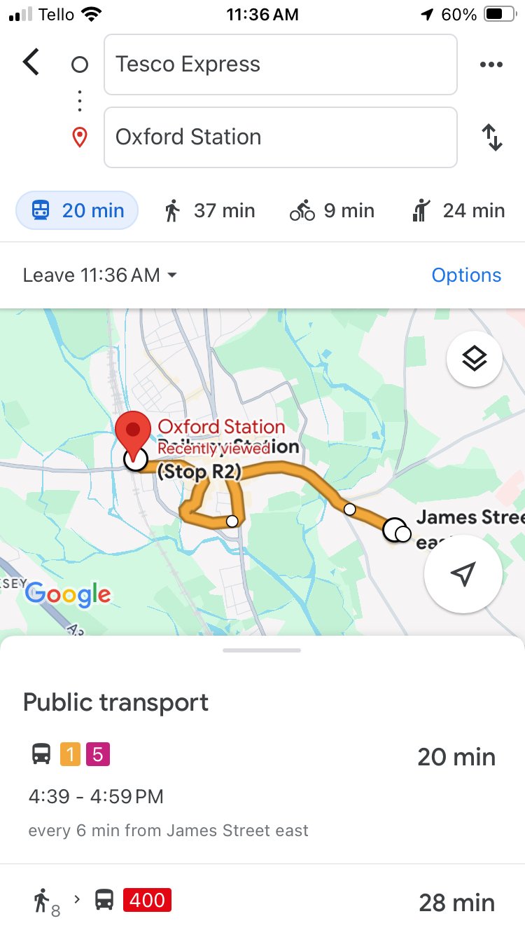
On Google Maps you can compare how long it will take to reach your destination by public transport, walking, cycling, taxi or driving. Just look for the icons above the map after you’ve typed in your destination and starting point (slide with your finger to reveal more!).
Like with CityMapper, you’ll be able to see when the next bus or train arrives, and how much walking you’ll need to do to and from the stops.
It defaults to showing your options for leaving now, but you can also plan future journeys by tapping where it says “Leave” and the current time, and then changing it to when you would like to arrive at your destination or leave from your starting point.
It will also default to showing you the fastest route, but you can ask it to show you the routes with the least transfers or the least walking by tapping “Options” above the routes shown.
If you tap on a public transport route that is showing and scroll to the bottom, you can tap “Agency info” to be directed to the websites for the companies running the route that is showing. There you can find information about prices and buy tickets.
Updated November 2025